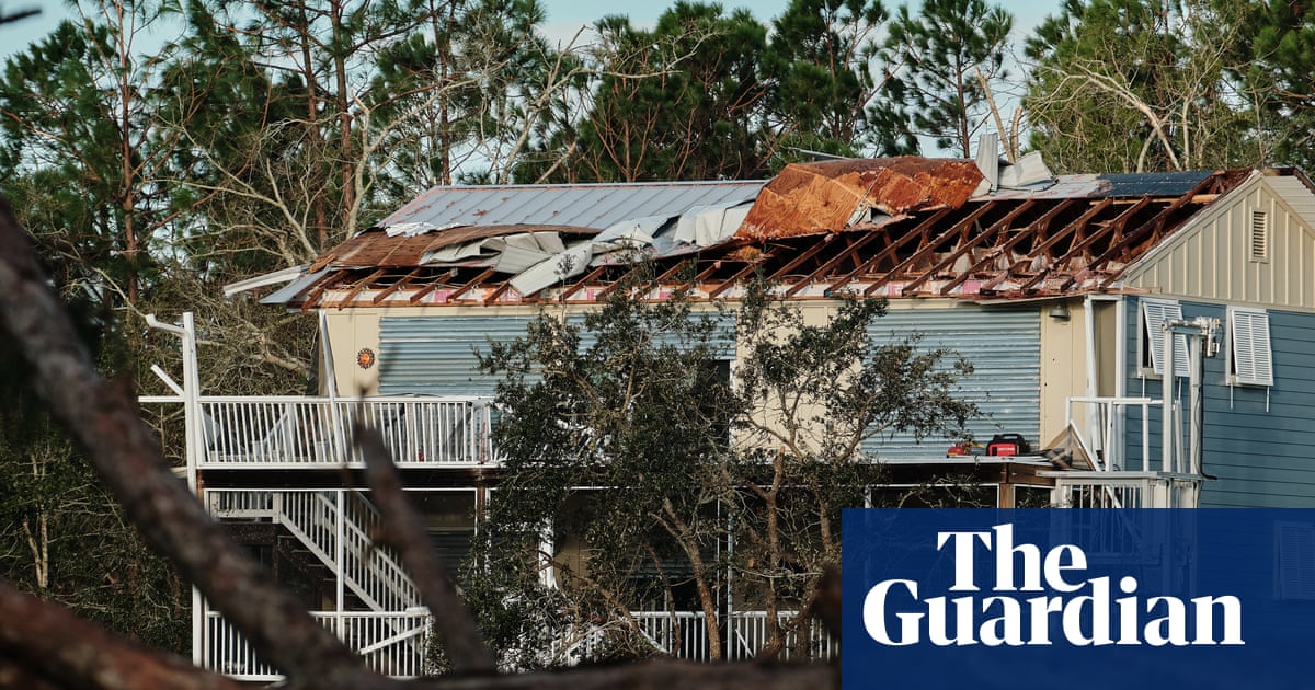
At least four people were reported dead Saturday in the middle of Isaias after it made landfall Friday night on the Florida panhandle as a Category 2 hurricane, according to authorities. The storm also downed trees, knocked out power to hundreds of thousands and flooded roads, but as Saturday night approached, the region was reopening. hurricanes. Two of the deaths reported during Isaias occurred in Escambia County, Florida, and two others were reported in Alabama, as the storm moved inland, local officials said. Of those deaths, one occurred in Escambia and Birmingham, Alabama, when trees fell on homes. Another person whose death was linked to Isaias was found in a locked garage with a running generator in Escambia County. Four members of that person’s family have been transported to the hospital with carbon monoxide poisoning, the Escambia Sheriff’s Office said. “Do not run any generator inside your home, it can be very, very dangerous,” Florida Gov. Ron DeSantis said at a news conference. People recover their belongings from a boathouse that collapsed after Hurricane Isaias in Destin, Florida, on Saturday. Photograph: Gerald Herbert/AP In Alabama, Governor Kay Ivey said Isaias, which is expected to dissipate on Sunday, “can’t clear up fast enough”. Meanwhile, although it had weakened to a post-tropical cyclone on Saturday as it passed through central Alabama, Isaias still posed threats of flooding and tornadoes as it moved inland, meteorologists and officials warned. The city’s mayor said the airport “suffered some damage.” The storm leveled a boathouse in Destin and tore off part of the facade of a skyscraper in Panama City Beach. A worker in the parking lot of a condominium swept piles of insulation from the building while others replaced beach chairs that had been thrown over. Lee Glessner begins removing branches from a fallen tree blocking a road after Hurricane Isaias made landfall in Milton, Florida, on October 10. Photograph: Dan Anderson/EPA “Remember, there can still be flooding due to rising rivers,” Jared W. Perdue, secretary of the Florida state department of transportation, said at a news conference. “I’m just going to remind all of you: Please, if there’s standing water or running water at the top of a road, don’t drive on it. “It doesn’t have to be that deep and it can sweep away your car, it can sweep away a human being, it can get very dangerous very quickly.” Nearly 550,000 customers were still without power in Florida, Alabama and Georgia on Saturday afternoon as those in the path of the storm began the cleanup process, according to PowerOutage.us. While still high, the number of Blackouts decreased from more than 900,000 on Saturday. Dark clouds hover over a historic Catholic church on Friday in Mobile, Alabama. Photograph: Octavio Jones/AP Storm surge and tropical storm warnings associated with Isaias had been discontinued by then, the National Hurricane Center (NHC) warned there would still be “substantial impacts” associated with Isaias across much of the southern Alabama peninsula. “Flash, urban and river flooding is possible throughout the region,” the NHC said in a Saturday morning advisory, adding that there was considerable potential for flash flooding and landslides in the southern Appalachians. [Saturday] Isaias through Sunday is expected to produce rainfall amounts of 4 to 8 inches in southern Alabama, the Florida and Big Bend regions, and southwest Georgia. Localized totals of up to 15 inches are possible, particularly within rain bands across the Florida Peninsula and Big Bend. In an aerial view, an apartment complex is seen after the roof was blown off when Hurricane Isaias passed through the area on Saturday in Milton, Florida. Photograph: Joe Raedle/Getty Images Across much of the rest of the southeastern US, rainfall amounts of 2 to 5 inches are expected, and higher localized amounts of up to 10 inches are possible, especially in the southern Appalachians and coastal Carolinas. The hurricane’s maximum sustained winds were 105 mph (169 km/h), strong enough to sound like “a train whistle,” Tim Mowry told the Associated Press after calling the storm home. Pensacola, Florida.skip newsletter promotion Free Newsletter | About 2 to 3 times a day Subscribe to Breaking News US Get the top stories as they are published after newsletter promotion Mowry described the loss of power Friday afternoon, but said he could rely on a generator. She said her son tried to drive home after his house, about 15 minutes away, lost power, but had to turn around because downed trees and power lines blocked the road. “I feel a lot more relieved today,” she said. The storm is underway, including possible tornadoes, the agency said Saturday. Several roads have already been blocked by fallen trees around Atlanta, local media reported. The formation of Isaias in October with maximum sustained winds of 105 mph marked a stark contrast to historical trends. The National Oceanic and Atmospheric Administration (Noaa) predicted a quiet year in terms of hurricanes at the beginning of a season that officially begins annually on June 1. The NOAA anticipated between three and six hurricanes, well below the average of seven. An August forecast from Noaa reduced the expected number to between two and six. record, tying a record set on October 8, 1905. Otherwise, the second-latest date for the first hurricane in the Atlantic was September 11, in 2002 and 2013. None of the eight previous named storms of the 2026 Atlantic season intensified above tropical storm level. The Associated Press contributed reporting