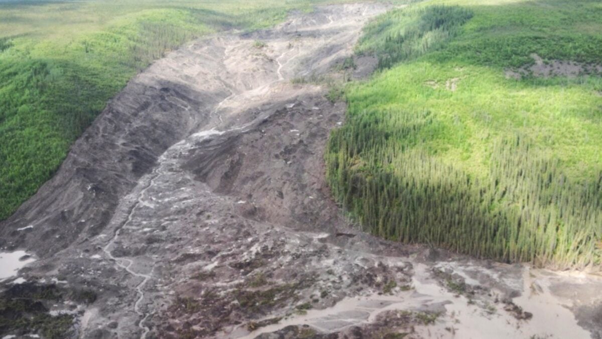
In 2017, a massive landslide hit the Johnson River Valley in Canada’s Northwest Territories, dislodging house-sized chunks of permafrost and leaving a 2-mile (3-kilometer) scar on the landscape. The scale of this event was unlike anything seen before in the region. Then, a year later, it happened again in the Redstone River Valley. The 2018 event was smaller, but still massive. It moved about 160 million cubic feet (4.5 million cubic meters) of debris, about a quarter of the amount displaced by the 2017 landslide. Once again, huge slabs of frozen soil were dislodged and moved downhill, in stark contrast to the oozing mud typical of melted permafrost. New scientific research into these two extreme events suggests they belong to a new class of landslides that researchers call “permafrost calving slides.” The study, published in the journal Geophysical Research Letters, shows that these events could become more common as temperatures rise and wildfire dynamics change. Melting permafrost in reverse A team of researchers led by Joseph Young, who completed the study as a doctoral student at the University of Alberta, used satellite imagery, drone studies, field samples, geophysical measurements and computer models to characterize the 2017 and 2018 landslides and investigate how they happened. Both were located in the permafrost discontinuous zone of the central Mackenzie Valley, where the continuously frozen soil layer is typically 66 to 131 feet (20 to 40 meters) thick and is close to melting at 30.2 degrees Fahrenheit (-1 degree Celsius). Between 1980 and 2020, permafrost warmed about 0.3 degrees C (0.5 degrees F) per decade. And in 1995, serious forest fires devastated the areas where the two landslides occurred. Based on their findings, Young and his colleagues believe that rising surface temperatures and sudden warming from wildfires initiated small movements of permafrost that created cracks in the ground, allowing water to drip deep into the earth and melt frozen soil from below. This “bottom-up” melt is atypical of permafrost, which generally melts from the top to the bottom, creating a slushy slurry on the surface. When the base of the permafrost melts, the entire frozen layer can break loose and slide rapidly downhill in huge cohesive blocks. That’s exactly what happened during the landslides of 2017 and 2018. What’s more, it can take 20 years for the water dripping through those top cracks to reach the bottom of the permafrost layer, so it makes sense that these events occurred about two decades after the 1995 wildfires. An Unstable Future Researchers say they have identified hundreds of similar landslides in permafrost layers less than 40 meters (131 feet) thick and warmer than -1 degree C (30.2 degrees F) across the Mackenzie Valley. While they have not yet damaged any infrastructure in this remote region, the exceptionally large events of 2017 and 2018 dammed rivers and created new lakes. As climate change raises temperatures and causes larger, hotter, longer-lasting wildfires, Young and his colleagues expect these landslides to occur more frequently in Canada and Alaska. Future events will offer new opportunities to study this emerging danger and understand how it is reshaping this rapidly changing region.