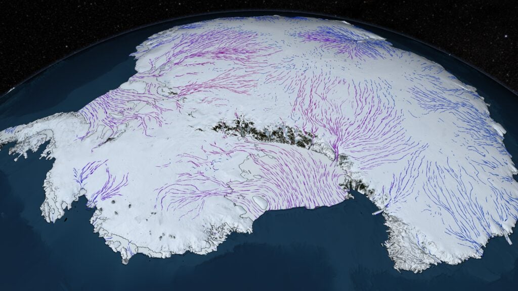
Antarctica did not wait for the Earth to cool as much as it does today. In the Eocene-Oligocene transition, about 34 million years ago, ice expanded across East Antarctica while global temperatures were still about five degrees Celsius above the modern level. The Arctic remained virtually ice-free for almost another 30 million years. The fall in atmospheric carbon dioxide remains the main trigger of this change. A 2026 study in Science adds a much slower preparation beneath the continent: Mantle processes linked to the Jurassic breakup of Antarctica and Africa gradually uplifted East Antarctica into a mountain-topped plateau. The extra height allowed the snow to outlast the summer and gave the ice a place to start accumulating. The result is a chain of patterned cause and effect, not a direct movie of ancient geology. The researchers integrated geodynamic and topographic reconstructions with energy balance and ice sheet models. Their simulations show that the uplift could have moved the landscape through a glaciation threshold long before the global climate reached modern temperatures. A warm world became an ice house The transition almost 34 million years ago was one of the largest climate reorganizations of the Cenozoic Era. The Earth went from the warm greenhouse conditions of the Eocene to the colder Oligocene. An East Antarctic ice sheet formed on a continental scale, sea level fell sharply, and the glowing ice began to affect the global climate. The moment needs care. Geological evidence indicates that isolated, unstable glaciers appeared in Antarctica before the main transition. A community reconstruction of Cenozoic carbon dioxide places the continent-wide glaciation at about 33.9 million years ago, after approximately ten million years of general CO₂ decline. The event did not create the first ice patch in Antarctica. It established a long-lasting ice sheet on a continental scale. The five-degree comparison used in the new study team’s GFZ research summary refers to global climate, not the temperature at a single Antarctic site. Ancient global temperature estimates carry uncertainty, but the central puzzle remains: a huge southern ice sheet appeared in a warmer world than today. The delayed response from the North exacerbates this enigma. The Arctic did not gain comparable permanent ice until nearly 30 million years later, despite experiencing the same broad change in greenhouse forcing. Antarctica had a continental mass centered at the pole and, in the new reconstruction, an increasingly high interior. The asymmetry suggests that global temperature alone cannot explain when each pole crossed its glaciation threshold. Continental breakup released a very slow signal from the mantle. The proposed preparation began during the Jurassic, when Antarctica and Africa were separating as Gondwana broke up. The stretching and rifting altered the thick continental plate and the mantle beneath it. According to the model, dense material from the bottom of the plate broke off in coordinated blobs. That loss of dense material made the surface above more buoyant, in the same way that unloading weight allows an object to rise. The detachment pattern moved inward from the split margins. Researchers call this propagation process a mantle wave. It is not a seismic wave that passes through rock in minutes. It develops over tens of millions of years and leaves a sequence of uplift on the surface. The accepted manuscript record of the study describes the mechanism as a mantle surface feedback rooted in continental breakup. That origin is important because the eventual birth of the ice sheet would depend in part on tectonic events that began more than 100 million years earlier. The long delay is a characteristic of the mechanism. Continental breakup did not immediately create an ice-ready plateau. Instead, the disturbance was followed by a profound reorganization of the material and an uplift that migrated through the interior. Rhythms that would be imperceptible throughout human life can reshape an entire region when they operate over tens of millions of years. Two kilometers became the critical height. The model reconstructs an East Antarctic coastal escarpment, a high inland plateau and the Gamburtsev Mountains now buried under ice. Until about 50 million years ago, most of the Gamburtsev landscape in the reconstruction was below 1.5 kilometers. About 45 million years ago, large areas had risen beyond a critical elevation of around two kilometers. Elevation changes the annual snow budget. The air is generally colder at higher altitudes above sea level. A modest increase can separate snow that disappears during the summer from snow that survives into the following winter. Once a persistent white surface forms, it reflects more solar energy than dark soil and further cools its surroundings. 34 million years ago, the team estimates that almost half of the Gamburtsev mountain range was above two kilometers. The resulting ice albedo feedback reduced global temperature by about one degree Celsius in the simulations. Colder, drier air reduced the warming provided by atmospheric water vapor, contributing to further expansion. Therefore, mountains were no substitute for cooling. They were a high-altitude hotbed that allowed the first long-lasting ice to appear in conditions that would have melted summer snow on lower ground. The team connected models of the mantle to the ice. No drill can recover a continuous record of the uplift of East Antarctica extending back to the Jurassic. The interior is hidden under miles of moving ice and erosion has modified the ancient landscape. Instead, the researchers tested whether several independent components of the model could produce a consistent story. Geodynamic simulations reconstructed mantle breakdown processes. Landscape models translated deep uplift into changing surface relief. Energy balance calculations estimated how latitude, elevation, snow, and reflected sunlight affected temperature. An ice sheet model then tested where the ice could nucleate and how far it could spread. The key comparison is counterfactual. A low-lying version of East Antarctica did not undergo the same early glaciation in relatively mild climates. The elevated version created cold highlands where mountain glaciers could persist and then melt as global cooling intensified. Agreement within this modeling chain does not guarantee the certainty of all old contours. Each component carries assumptions about mantle viscosity, erosion, past atmospheric conditions, and how the ice responds to bedrock. The value of the experiment is more limited but important: the rift-driven uplift is physically capable of producing the height, location and timing needed to help seed the ice sheet. Modern maps provide a check of overall geometry rather than a photograph of the ancient surface. A NASA visualization of Antarctic ice and bedrock shows why subglacial relief is important for presenting ice flow. Radar, gravity, seismic and satellite observations reveal mountains, basins and ridges, but their ancient elevations still need to be reconstructed. Carbon dioxide remains the main trigger. The new mechanism does not reduce greenhouse gases. The article explicitly starts from the evidence that a critical drop in atmospheric CO₂ was mainly responsible for the Antarctic glaciation. The uplift changed how much cooling was needed and where the first stable ice could form. SpaceDaily previously reported on indirect and modeled evidence that declining carbon dioxide drove the greenhouse-to-greenhouse transition. Only simulations that included lower levels of CO₂ reproduced the cooling found in Earth’s temperature records. The new mantle study complements that result rather than nullifying it. Ocean access routes and circulation also evolved. A 2021 ocean model study found that widening passages and weakening gyres could cool the Southern Ocean, altering the regional threshold for glaciation. Orbital variations determined how sunlight was distributed. Ice elevation, albedo, and water vapor provided feedback after growth began. The ice sheet arose from this combination. The fall in CO₂ provided the global push towards a colder climate. Tectonic uplift created unusually favorable terrain in the south. Oceanic and atmospheric feedback helped turn mountain ice into a continental cap. Ancient oxygen isotopes do not reduce history to the volume of ice. Much of the history of the Antarctic climate is inferred from oxygen isotopes in the shells of marine microorganisms. These records respond to both the amount of water stored in land ice and the temperature of the ocean, making a large change in isotopes possible without an equally large change in ice volume. A recent SpaceDaily report described evidence that later Oligocene isotopic oscillations largely reflected deep ocean temperatures. That result refers to climate variability after the first great ice age, but illustrates why multiple types of evidence are needed. Neither a substitute nor a model can reconstruct the entire transition. The mantle wave hypothesis draws attention because it connects surviving topography, the timing of continental breakup, modeled uplift, and the physical requirements of permanent snow. It remains a reconstruction with uncertain mantle properties, erosion histories, and ancient boundary conditions. Training is not a predictor of modern survival. A warmer ancient Earth supporting Antarctic ice does not mean the current ice sheet is safe under current warming. The interior of East Antarctica is high, but much of Antarctica’s vulnerable ice meets the ocean or rests on bedrock below sea level. Warm water can attack floating platforms and stranding areas without waiting for summer air to melt the plateau. The rates are also unmatched. The rising of the mantle prepared East Antarctica for more than 100 million years. Modern greenhouse forcing is changing the climate over centuries. A slowly rising landscape can determine where an ice sheet first becomes possible without protecting every part of that sheet from rapid subsequent warming. The deepest lesson from the study is that climate thresholds are partially written into geography. Processes far below Antarctica raised the stage. The fall of carbon dioxide provided the cooling. Once snow could survive on the new high ground, ice and atmospheric feedback helped transform a mountain refuge into a continental-scale layer. About this articleThis article is for general information and reflection. It is not professional advice. For your specific situation, consult a qualified professional.