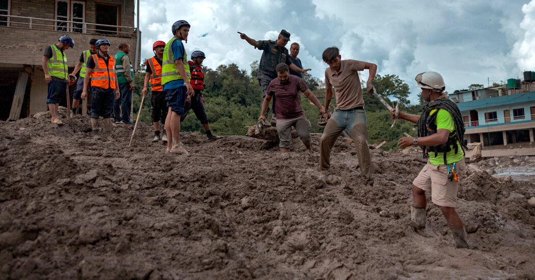
Scientists who gathered satellite images and seismological data said Thursday that a high-altitude landslide that coincided with a glacial collapse likely caused deadly flash floods in Nepal and Tibet. Glaciologists and geologists had already determined that a huge chunk of glacier had broken off on Wednesday morning. On Thursday, a group of scientists analyzing the events leading up to the flood said newly available images, captured at a time with fewer clouds, show that a huge chunk of mountainous bedrock beneath that glacier had also given way. “The rock on which the glacier sat collapsed,” said Kristen Cook, a geomorphologist at Grenoble Alpes University in France. The combined force of the collapse sent millions of metric tons of rock and ice into the valley, he added. “It was a much larger collapse than we were initially able to see in the satellite images,” he said. The deluge of rock and ice, which was pulverized into mud and water as it moved down the mountainside, was so powerful that the U.S. Geological Survey recorded the landslide as a magnitude 5.2 seismic event. That this event was recorded as an earthquake is not unusual. Whenever a large amount of energy is transferred to the Earth’s crust (from an earthquake, an asteroid impact, or even a crowd of people jumping at a concert) seismic waves are produced, which are detected by seismometers around the planet. This debris flow would have released the same amount of energy as 1,000 tons of TNT. “Perhaps more important than energy is that we can directly calculate mass from our force estimate. This is equivalent to almost 400 million metric tons,” said Stephen Hicks, a seismologist at University College London. To put it another way, this landslide was comparable to 1,000 Empire State buildings crashing simultaneously into the river valley. Warming temperatures caused by climate change may have destabilized the rock face, the scientists said, but added that it was too early to determine a precise cause. The landslide and glacier collapse took place on the north face of Langtang Lirung, a Nepalese mountain near the border with Tibet, at an elevation of around 17,000 feet, according to the scientists. Langtang Lirung Peak, part of the Langtang Himal Mountain in Nepal, in 2022. Credit…Nicolas Economou/NurPhoto, via Reuters “Basically, a piece of the mountainside collapsed,” said Daniel Shugar, a geologist at the University of Calgary in Canada, who is part of the group. Scientists are slowly building a more detailed picture of the chain of events that led to Wednesday’s flooding. The torrents swept through the Himalayan valleys between Nepal and China’s Tibet region, devastating villages, killing hundreds and leaving more than 1,000 people missing. According to Dr. Cook, the flow of rock and ice incorporated water and sediment from the river as it fell downstream along a network of rivers and tributaries, reaching tens of kilometers from the site of the original landslide. While the new images contributed to scientists’ understanding of the cause of the disaster, many questions remained. Among them are how much rock and ice was released by the landslide and why the volumes of flood water were so enormous. Dibas Shrestha, a hydrology and meteorology expert at Tribhuvan University in Nepal, said in an email that he “could not even imagine the volume of ice, water and rock mixture flow we have witnessed downstream.” Videos taken at the Gyirong border crossing between China and Nepal show a wall of water overtaking the area. One possibility, scientists say, is that the landslide created dams upstream that eventually burst, unleashing a huge gush of water. Mohan Bahadur Chand, a Himalayan glaciologist and assistant professor at Kathmandu University, said an initial hypothesis is that accumulated debris temporarily blocked the Lhende River, causing a catastrophic overflow. As higher-resolution satellite images become available in the coming days, Dr Chand said it could become clearer what part of the glacier had broken off and what other sediment had been washed into the water. From there, it would be possible to calculate the volume of water that had swept through the region, he said. Judson Jones contributed reporting.