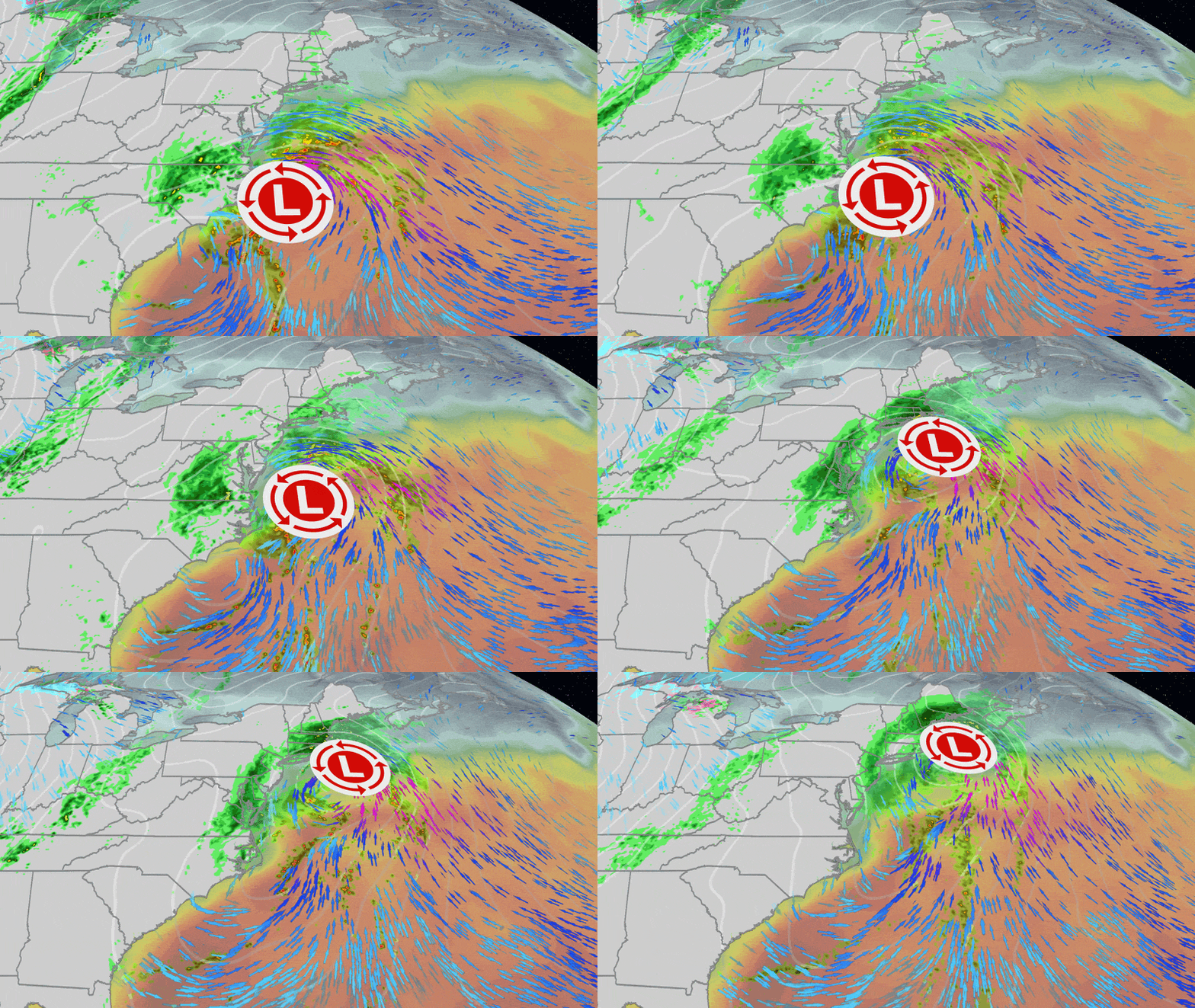
The storm that will track along the East Coast could become Subtropical Storm Kyle. An East Coast storm that brought torrential rain, winds and coastal flooding to parts of the Southeast is moving northeast. Delays are expected for travel to New York City and Boston. This storm has already brought record rainfall to some parts of Florida. Now: Soaked in the Mid-Atlantic An area of low pressure that formed off Florida’s Atlantic coast is moving north. Heavy rain is now spreading to Georgia and the Carolinas. What is expected for the east coast? Low pressure will move northeastward by the end of the weekend. These rain bands could extend inland and also well north of the center of this depression. Get more of our news on Google Set The Weather Company as a ‘preferred source’ for faster access to the news you value. Sunday looks clearer from Charleston, South Carolina, to the south, as the heaviest rain will have moved northeast and could soak New York City, Philadelphia and Boston. Consider canceling any weekend beach plans along the southeast coast due to this rain forecast, and stay out of the water as the threat of breaking waves and rip currents will be high. (MAPS: US 7-Day Daily Rain Forecast) The map above shows where locally heavy rain is likely from this storm through Tuesday in the darker green outlines. This could lead to some flash flooding, especially in flood-prone urban areas. The wind threat appears relatively modest compared to other coastal storms, although at least some tree damage and power outages are possible Sunday and Monday near the northeast coast. At least some coastal flooding during high tide, heavy surf and rip currents are a good bet from the Virginia Tidewater to New England. Compounding this coastal flooding threat is the monthly peak of astronomical high tides with Tuesday’s full moon. Any rainfall and pushing of ocean water will accumulate into this monthly king tide. If you have Thanksgiving week travel plans later on Sunday or Monday in major centers in the Northeast, weather-related flight delays may occur. (MORE: Thanksgiving Travel Weather Forecast) Records Have Been Erased The combination of this latest heavy rain event, another in early November, and a generally wet stretch of fall has broken monthly, seasonal and even river crest records in the eastern Florida Peninsula. The rainfall in Melbourne is off the charts. Wettest month dates back to 1937 (22.59 inches through Nov. 19) Nearly 13 inches wetter than the previous wettest November in 1963 (9.72 inches), all in just 19 days Wettest fall (September to November), with 42.54 inches on Nov. 1. 2 was their wettest single-day record (11.51 inches). Fort Lauderdale (15.49 inches), Vero Beach (12.32 inches) and West Palm Beach (18.25 inches) also broke their record for wettest November. (EXPLAINED: Why Florida has seen so much rain and what’s next) And west of Cocoa Beach, the slow-flowing St. Johns River, still experiencing major flooding after the early November deluge, surpassed its October 1953 record flood, inundating neighborhoods. Jonathan Erdman is a senior meteorologist at Weather.com and has been covering domestic and international weather since 1996. Extreme and strange weather are his favorite topics. Reach him on Bluesky, X (formerly Twitter), and Facebook.