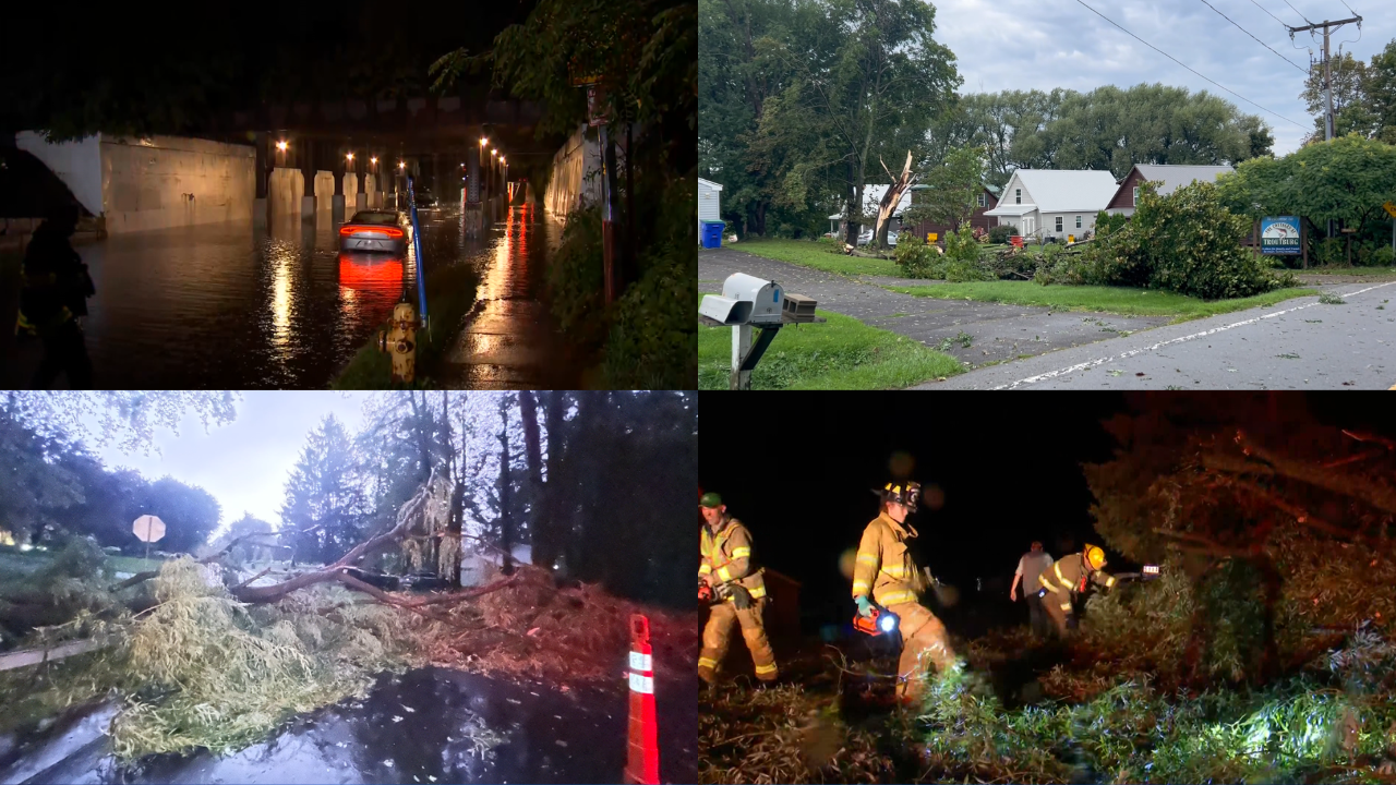
ROCHESTER, NY – The region is cleaning up Thursday after severe storms brought multiple tornado warnings, downed trees and power lines, flooded roads, large hail and widespread power outages. The National Weather Service is scheduled to survey storm damage in Shelby in Orleans County and Byron in Genesee County on Thursday after several tornado sightings yesterday. An Orleans County firefighter reported seeing a tornado touch down near Shelby Center, and viewers have been sending in photos of the supercell that may have produced a tornado around Shelby. If you have any photos of tornado-like clouds in your area, please send them to webmaster@whec.com. See our coverage of yesterday’s storms here and photos from spectators here. Wednesday night’s storms prompted tornado warnings for Monroe, Genesee, Orleans, Steuben, Seneca and Livingston counties, some of which lasted until 11 p.m. The National Weather Service will confirm in its study whether there was a tornado, how strong it was and how long it was on the ground. damage, and First Alert Meteorologist Nate Morris was live in Shelby and Byron with details on the NWS study and what a “tornado watch” means. Storm Damage in Webster Most of the remaining power outages in Monroe County occur in Webster. On Thursday morning, News10NBC saw a large tree topping power lines on Holt Road, tree branches damaging a lawn on Schlegel Road and some traffic lights out at intersections. We also saw RG&E crews working to repair damaged cables. When you go out on Thursday, be careful of flooded roads, underpasses and downed trees blocking roads. Utility crews remind people to stay at least 30 feet away from downed wires, as live wires carry high voltage that can cause injury or death. If a downed wire comes into contact with your vehicle, stay inside and wait for help. RG&E customers can report downed wires or other hazards by calling 1-800-743-1701. NYSEG customers can call 1-800.572-1131. More on tornado sightings The region received five tornado warnings Wednesday night. In two of them, in Shelby and Byron, people reported seeing a tornado. The National Weather Service will try to confirm those reports Thursday. The first reported tornado may have started as a waterspout, which is a tornado over a body of water. As First Alert meteorologist Nate Morris explains, the waterspout likely moved from Lake Ontario to the town of Newfane in Niagara County and then moved inland toward Shelby. Nate saw large fallen tree branches and debris scattered around Shelby. In Byron, Nate also saw some scattered debris, but said the damage didn’t seem as bad as Shelby’s. He said he wouldn’t be surprised if the reported tornado touched down, lifted off and then touched down again. Check back for updates on the NWS findings. Latest power outage figures More than 10,000 homes or businesses were still without power across the region as of Thursday morning. In total, more than 38,000 customers were without power at one point in Western New York and the Finger Lakes, according to RG&E and NYSEG. Here are the numbers as of 4:45 am:Monroe County: just over 4,000 for RG&EWayne County: just over 3,200 for RG&EOOntario County: 14 for RG&E and 63 for NYSEGLivingston County: 555 for RG&E and 560 for NYSEGOrleans County: 752 for National GridGenesee County: 1,096 for National GridYou can see the latest outage figures from RG&E here, NYSEG here, and National Grid here. Waterloo CSD closed Thursday The Waterloo Central School District will be closed Thursday due to a power outage following the storms. The first day of school isn’t until Tuesday, September 8, but staff were supposed to show up. For related stories: Storm damage Tornado warnings in Rochester region Wednesday’s storms